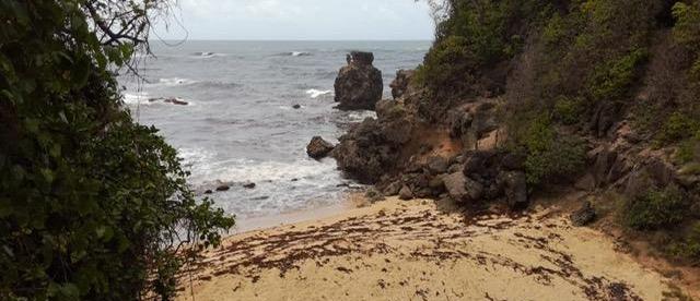
Archers Bay
Secluded sand & surf
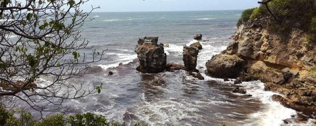
Archers Bay, about a mile and a quarter (2km) west of North Point, is a secluded beach encircled by jagged cliffs. At weekends Bajans come to lime (hang out and socialise) and picnic on the shady grassy patch on the clifftop. Some head down to the sand via a steep flight of steps. But even when the sea seems relatively calm, the dangerous undertow makes it too dangerous for swimming.
If a picnic’s not your thing, pop into nearby Catch 22 for a drink and bite to eat.
Transport
By car: 17 miles (27.4km) N of Bridgetown. Follow Highway 1A, up the West Coast, then continue along Highway 1B. Watch for the turnoff signposted to Catch 22 restaurant, at Crab Hill police station (40min).
By bus: Bus #1C from Princess Alice Bus Terminal (Bridgetown), which travels via Holetown and Speightstown, terminates at Connelltown, but passes the turnoff to Archers Bay (signposted to Catch 22 restaurant) on Highway 1B (50min). From there it is an easy walk – under a mile (1.4km) – to the bay.
Consult the bus timetable.