Nice Beyond: Driving the Roya
Amazing mountains, fast flowing rivers and a valley of marvels

The Niçois, or inhabitants of Nice, often refer to the impressive, beautiful mountainous territory above the City somewhat mysteriously as the ‘Beyond’ but it is officially known, more prosaically, as the ‘Pays Arrière Niçois’ or Nice’s Back Country. Part of the old County of Nice, nowadays much of it is contained within the Mercantour National Park.
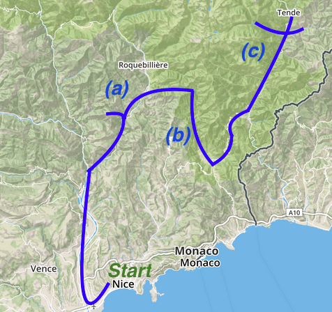
There are high mountains such as the Cime de Gélas (3143m) and Mont Bégo (2872m), picturesque mountain villages such as La Bollène Vésubie, Sospel and Saorge and, if that’s not enough, wild wolves roam the upper reaches of this wilderness. There are two main itineraries and this one tends to cover the Eastern side of the Mercantour and the Vallée-de-la-Roya.
Before you begin: Get a copy of the Michelin Departmental Map 341. This drive involves negotiating some challenging roads but Nice Beyond can be reached in over an hour from the city. Part of the itinerary can easily be accomplished in one day but an overnight stay (or two!) would allow you to explore much more. It is also possible to travel by train from Nice to Tende, on the Train des Merveilles.