TouchScreenTravels logo

TouchScreenTravels

Our Touch, your Travels…

This is a preview of the full content of our Peru’s Best app.

Please consider downloading this app to support small independent publishing and because:

  • All content is designed for mobile devices and works best there.
  • Detailed in-app maps will help you find sites using your device’s GPS.
  • The app works offline (one time upgrade required on Android versions).
  • All advertising (only present on Android versions) can be removed.

The app will also allow you to:

  • Add custom locations to the app map (your hotel…).
  • Create your own list of favourites as you browse.
  • Search the entire contents using a fast and simple text-search tool.
  • Make one-click phone calls (on phones).
iOS App Store Google Play

Alpamayo Trek

Los Cedros–Alpamayo (8–12 days)

Alpamayo

This is one of the longer treks, with options from 8 to 12 days, up to 92km (57 miles). The elevation on this trek ranges from 3150m (10,335ft) to 4850m (15,912ft). You must bring all of your food and equipment with you.
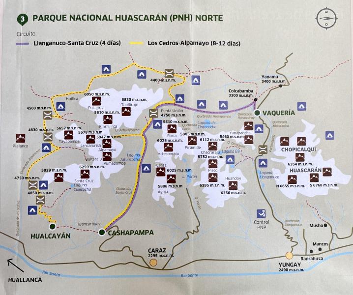
Alpamayo Trek Map

Most start their trek from the village of Hualcayán and end in Cashapampa. You’ll need to get transportation to the town of Caraz and from there to Cashapampa or Hualcayán.

Cordillera Blanca Treks

Text © Heather Jasper

Images by Cristian Ordenes, Free Map Distributed by iPeru