TouchScreenTravels logo

TouchScreenTravels

Our Touch, your Travels…

This is a preview of the full content of our Cook Islands’ Best app.

Please consider downloading this app to support small independent publishing and because:

  • All content is designed for mobile devices and works best there.
  • Detailed in-app maps will help you find sites using your device’s GPS.
  • The app works offline (one time upgrade required on Android versions).
  • All advertising (only present on Android versions) can be removed.

The app will also allow you to:

  • Add custom locations to the app map (your hotel…).
  • Create your own list of favourites as you browse.
  • Search the entire contents using a fast and simple text-search tool.
  • Make one-click phone calls (on phones).
iOS App Store Google Play

Hiking

Rarotonga's Cross Island Track

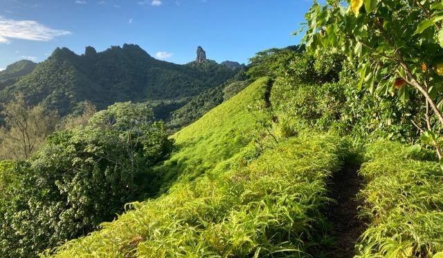
There are a number of hiking tracks on the island, but the Cross Island Track is the crowning glory. Confident, experienced hikers can take this on themselves, otherwise take a guided hike with Maunga Tours.

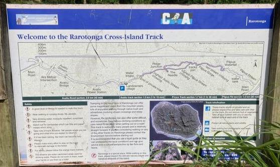
It’s recommended to hike from north to south. From Avarua, head south and inland on Uruau Dr to the start of the track, where you’ll find the following signboard:

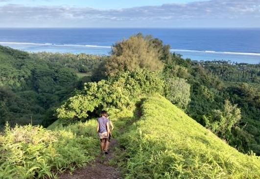
Follow the orange markers. The high point is “The Needle” (Te Rua Manga) at 413m, and if you’ve come by car to the northern trailhead, you may want to climb to here, then return to your car.

Allow 3-4 hours for the reasonably hard hike across to the southern end of the track at Wigmore’s Waterfall. From there, Papua Rd heads out to the southern coast.

Tours

Maunga Tours run guided mountain walks on Rarotonga, including the Cross Island Track. Pick up and drop offs are included.

Practical Info Practical Info icon

Rarotonga Hiking Watch the hiking tips video.

Hiking Safety Tips

Rarotonga Activities

Text © Craig McLachlan

Images by Craig McLachlan