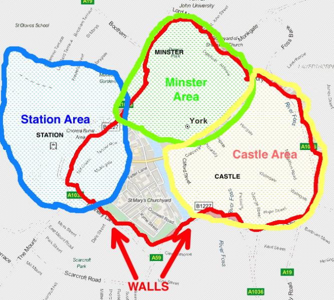
TouchScreenTravels logo

TouchScreenTravels

Our Touch, your Travels…

This is a preview of the full content of our York’s Best app.

Please consider downloading this app to support small independent publishing and because:

  • All content is designed for mobile devices and works best there.
  • Detailed in-app maps will help you find sites using your device’s GPS.
  • The app works offline (one time upgrade required on Android versions).
  • All advertising (only present on Android versions) can be removed.

The app will also allow you to:

  • Add custom locations to the app map (your hotel…).
  • Create your own list of favourites as you browse.
  • Search the entire contents using a fast and simple text-search tool.
  • Make one-click phone calls (on phones).
iOS App Store Google Play

DISTRICTS

York, Streets

York's main sights can be roughly grouped into three geographic areas: the largely pedestrianised Minster Area, the more shopping-orientated Castle Area, and more-transport orientated Station Area.

The Footstreets

Most visitors spend most of their time in pedestrianised footstreets – core streets inside the City Walls that are vehicle-free during the day (10.30am–5pm; even bikes are banned). For a map of the footstreets visit this site

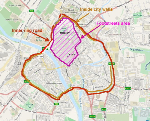
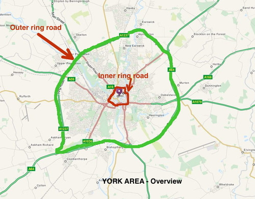
Inner & Outer ring roads

An inner ring-road follows circles around the outside of the city walls. An outer ring-road more-or-less identifies the city limits by skirting around its fringes.

The Castle Area

The Minster Area

The Station Area

Text © Raymond Williams

Images by , Martin Pettitt, RAYMOND WILLIAMS